

Godrevy to Portreath
The Route
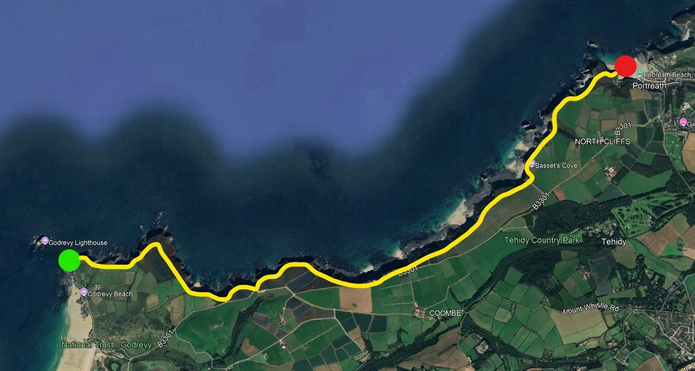
Godrevy to Portreath is about 5.5miles
Discovering the Rugged Beauty Between Godrevy and Portreath
This stretch of the Cornish coast, from the iconic Godrevy Lighthouse to the vibrant village of Portreath, is one of the most dramatic and unspoiled sections of the South West Coast Path. It offers a constantly shifting landscape of towering cliffs, secluded coves, windswept heathland, and breathtaking Atlantic views.
Beginning at Godrevy, you're greeted with sweeping views across St Ives Bay and the instantly recognisable lighthouse perched on its rocky island. Just around the headland, Mutton Cove is a known haul-out spot for grey seals — often seen lazing on the sands far below.
The path then winds across Navax Point, where the cliffs begin to rise and the wind sharpens. Wildflowers cling to the edges in spring and summer, while kestrels and peregrines patrol the skies above. As you continue, you’ll reach the sheer drop of Hell’s Mouth — a dramatic chasm in the cliffs where the power of the Atlantic is on full display.
Further along, Basset’s Cove offers a moment of unexpected tranquillity — a tucked-away bay framed by crumbling cliffs and rolling green slopes. The trail continues across Carvannel Downs, where panoramic views and open skies lead the way toward Portreath, once a bustling port and now a charming seaside village with golden sands and rich mining heritage.
Whether you're here to hike, photograph, drone, or simply breathe it all in, this wild coastal stretch delivers some of the most rewarding scenery in Cornwall — a place where every bend in the path reveals something new, raw, and unforgettable.
The Conditions Wern’t The Best
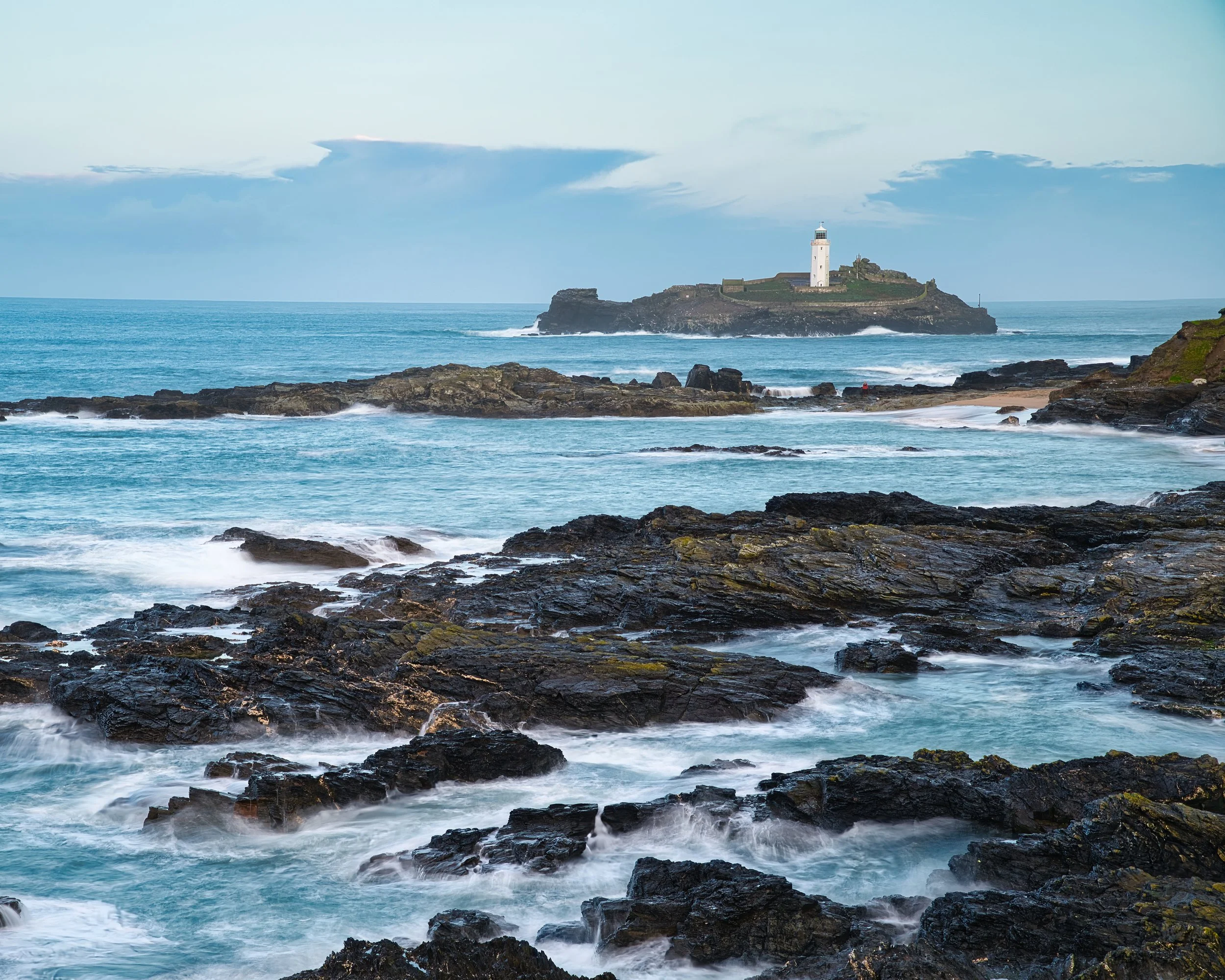
Godrevy Lighthouse
DAY 1
A Wet Morning at Godrevy: Chasing Light Between Showers (rain stopped play)
Some mornings just don’t go to plan — and this was one of them.
I arrived at Godrevy with cautious optimism. The air was thick with sea mist and a light drizzle hung in the breeze — not ideal, but I’ve learned that Cornwall’s coast can surprise you if you give it a chance. And for a brief moment, it did.
The rain held off just long enough for me to hop out of the car and grab my gear. I had a few shots in mind: low-angle compositions across the black rocks, the lighthouse glowing white against the blue-grey sea, maybe even some moody B-roll to kick off a new cinematic intro. But no sooner had I set up the tripod than the drizzle turned into something heavier. Classic.
Rather than force it, I retreated to the car — windscreen fogged, flask steaming. I waited… 20 minutes. Watching the waves crash across the island, seals possibly bobbing in the swell beyond view (which just turned out to be buoys), and that stubborn, unbroken ceiling of Cornish cloud refusing to lift.
Eventually, I called it. Packed up, drove home. No drama, no heroic hike — just a reminder that sometimes nature decides your schedule.
But honestly? I still like what I got. There’s something about Godrevy in the rain that feels… real. The lighthouse standing firm through it all. The black rock glistening. The ocean pressing in. It might not have been the epic sunrise I was hoping for, but it was still worth it.
Sometimes you go out to capture the perfect light — and come back with a story instead.
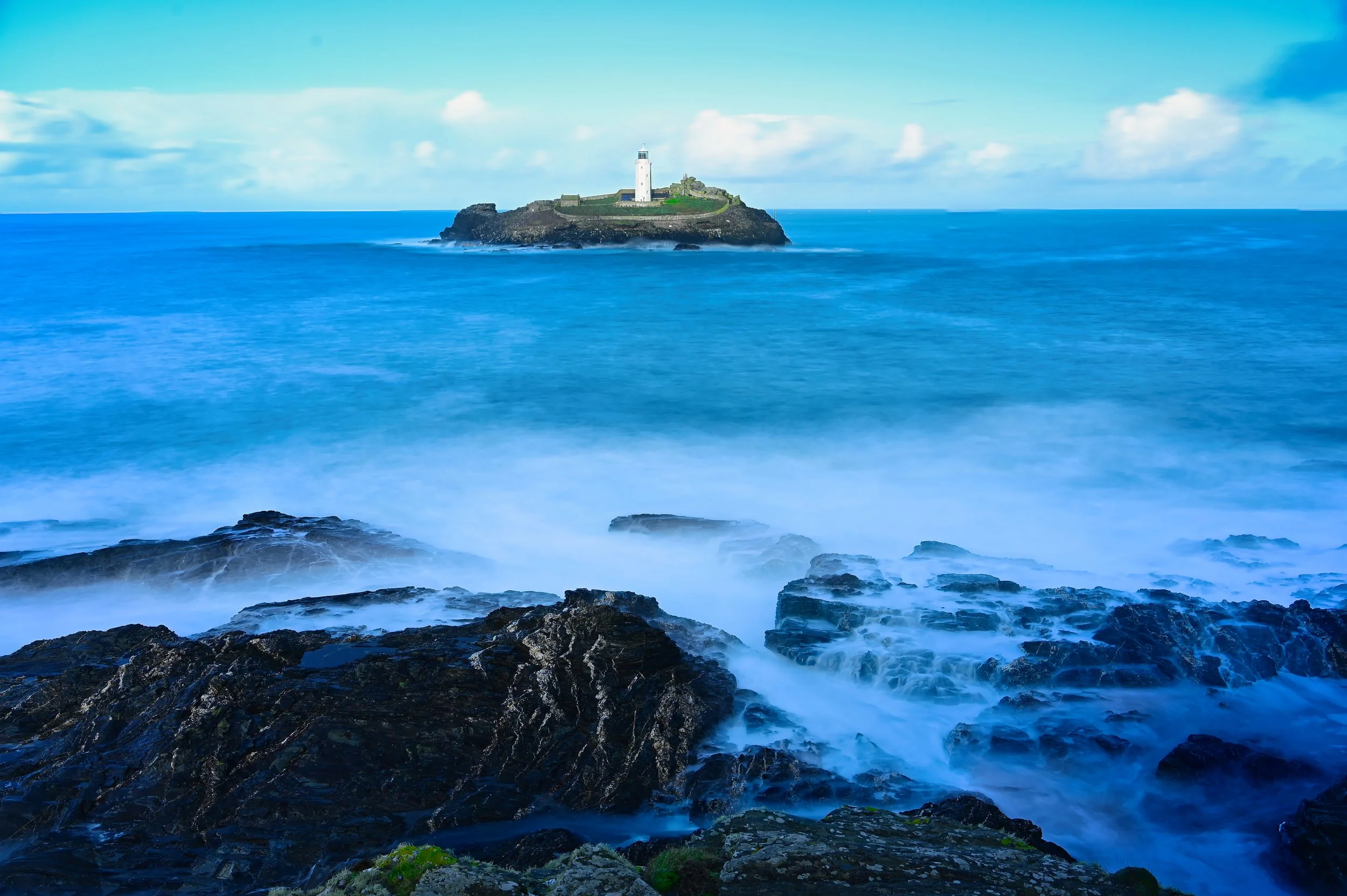
Return to Godrevy : Long Exposure and a Lighthouse Flight
It was nice to see the sun..!
DAY 2
After last week’s complete washout at Godrevy, I wasn’t sure what to expect heading back up the coast. The forecast looked more promising, but this is Cornwall – you never really know until you step out of the car.
This time, it was worth the gamble.
As I pulled into the car park, the first thing I noticed was the absence of rain. No mizzle on the windscreen, no low blanket of murk, just a soft, hazy light and a slight onshore breeze pushing a steady set of waves into the bay. Godrevy Lighthouse stood out far more clearly than on my last visit – still moody, but with just enough contrast to make things interesting.
Chasing Waves and Long Exposures
I headed straight down towards the rocks with my tripod and filters. The sea was lively but not wild – that perfect middle ground where the waves have shape and texture without turning the whole scene into chaos.
I set up a few compositions looking across the dark, jagged foreground rocks towards the lighthouse on the island. With each set of waves rolling in and breaking over the reef, I knew it was a good chance to experiment with long exposures.
A strong ND filter went on the lens, and I slowed the shutter right down. In real time, the sea was crashing and surging over the rocks, but in-camera it transformed into a smooth, misty layer wrapped around the base of the lighthouse. The contrast between the solid, white tower and the soft, blurred water was exactly what I’d been hoping for the week before.
I took a series of frames, adjusting shutter speeds, timing the exposures so that the waves hit just as the shutter opened. Some shots captured streaks of white foam; others turned the water into a dreamy, almost cloud-like surface. Standing there listening to the constant rumble of the sea while the camera quietly clicked away felt like proper seascape therapy.
Taking to the Air
Once I was happy with the stills, it was time to get a different perspective.
Conditions were just about right for a safe flight – steady breeze, good visibility and no rain in sight. I launched the drone and sent it out over the water, keeping a careful eye on the wind and battery levels.
From the air, the whole scene opened up. The lighthouse sat like a small white sentinel against the darker rocks, with lines of swell rolling in from the Atlantic. I flew along the coastline, tracing the rugged line of cliffs and rock pools, then gently arced the drone around the lighthouse itself for a few sweeping passes.
Looking down, the long-exposure stills I’d just taken from the shore were replaced by a completely different view – bands of turquoise water, white breakers wrapping around the island, and the coastline stretching away towards the north cliffs. It’s always satisfying when you can combine ground-based photography with aerial footage and tell the story of a place from multiple angles.
A Small Win After a Washout
What made this trip feel extra rewarding was how it contrasted with the previous week. Back then I sat in the car watching the rain get heavier until I finally admitted defeat and went home. This time, the coast gave me a break – better light, more detail in the sky, and just enough wave action to bring the scene to life.
I left Godrevy with memory cards full of long exposures, drone clips, and a genuine sense that I’d finally captured a bit of the atmosphere I’d been chasing. It wasn’t an epic sunrise or a blazing sunset, but it felt real – a typical Cornish day where the weather behaves just enough to let you work.
Sometimes that’s all you need.
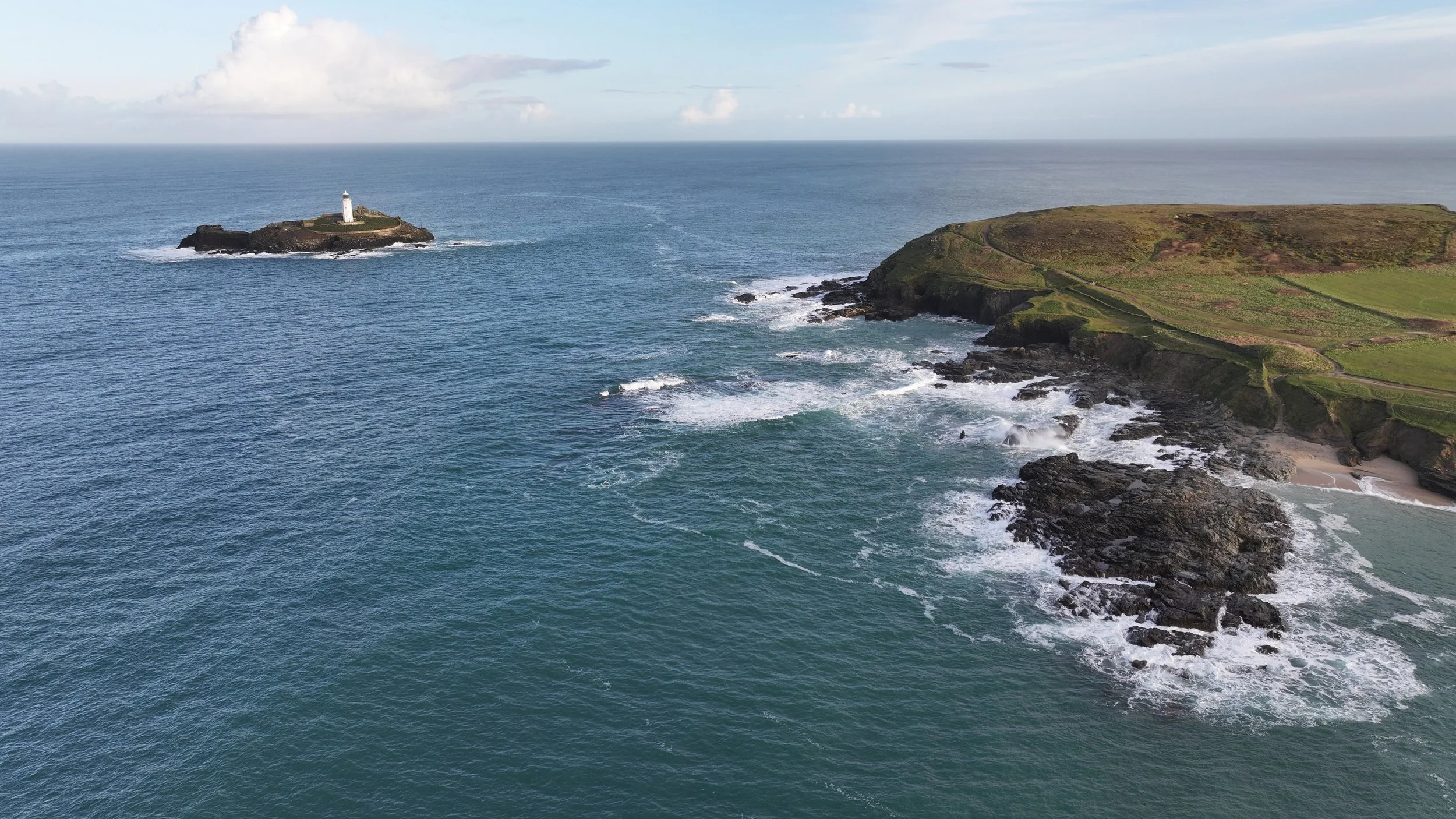
Navax Point
It was rather a windy morning..!
DAY 3
Some days on the Cornish coast feel wild. This one felt feral.
From the moment I left the car at Godrevy and started hiking up past the lighthouse, the wind made it clear who was in charge. It wasn’t just breezy – it was the kind of full-on, face-slapping Atlantic wind that tries to push you back down the path you’ve just climbed.
Climbing into the Wind
The path up from the lighthouse to the clifftop starts out innocently enough. You follow the well-worn track, glance back at the white tower on its island, and think, “This isn’t too bad.”
Then you hit the more exposed section.
As soon as I stepped properly onto the open cliff top, the wind hit me like a wall. It was constant, not gusty – a steady force trying to shove my tripod sideways and tug my backpack off my shoulders. Walking in a straight line became a bit of a joke. I found myself leaning into it, one step at a time, like I was trying to climb an invisible hill.
Still, this is exactly the kind of weather that gives this coastline so much character. The sea was whipped up into whitecaps, the grass flattened and rippling, and the sound of the waves crashing below was just a low, continuous roar underneath the wind.
Seal Watching at Mutton Cove
My first proper stop was Mutton Cove, one of my favourite spots along this stretch. From the clifftop viewing area you look straight down onto a sheltered little beach that, on a good day, is absolutely packed with grey seals.
Despite the howling wind, the cove itself felt oddly peaceful. Far below, away from the madness on the cliff tops, the seals were just… chilling. Some were sprawled out on the sand like oversized slugs, others rolled lazily in the shallows. A few lifted their heads now and then as another wave crashed in, but for the most part they looked completely unbothered by the weather.
I stayed there for a while, bracing myself against the fence and grabbing a few photos and a short video of the colony. Long lens work in that kind of wind is always a bit of a battle – every gust sends the viewfinder wobbling – but it was worth the effort. There’s something special about capturing that contrast: total chaos up on the clifftops, total calm on the beach below.
A Hidden Cove and a Serious Drop
From Mutton Cove I carried on along the South West Coast Path, heading in the direction of Navax Point. The views along this section are incredible – jagged cliffs, hidden inlets, and that endless Atlantic horizon – but the path also cuts close enough to the edge in places to really make you pay attention, especially when the wind is trying to hustle you sideways.
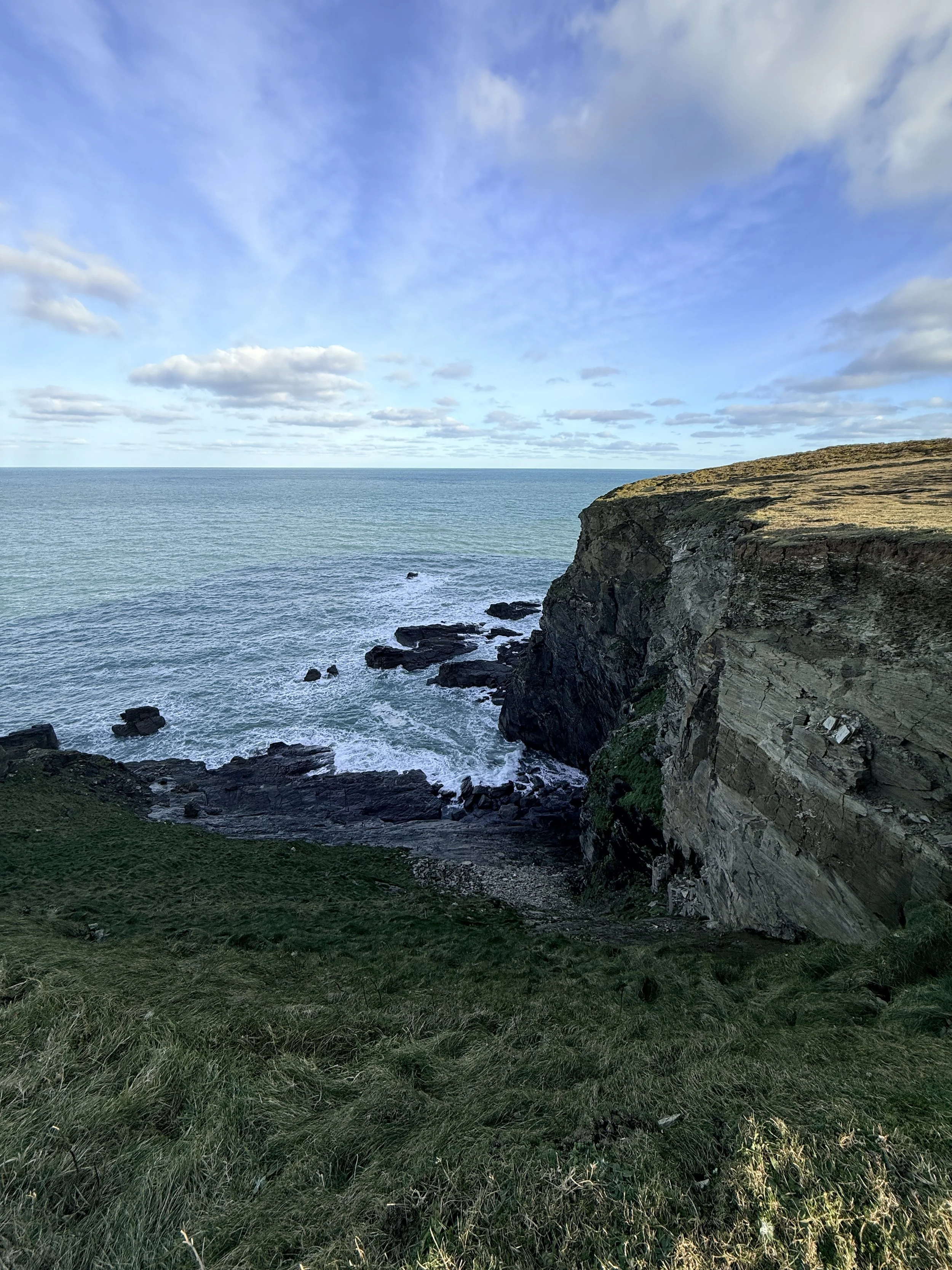
A little further along I stumbled across a small, unnamed cove that really stopped me in my tracks. The drop down to the sea was absolutely brutal – a near vertical plunge down a sheer rock face into churning water. No beach, no gentle slope, just cliffs and waves.
I stood there for a while, keeping a very respectful distance from the edge, just watching the swell slam into the rocks far below. It was one of those places that feels genuinely remote and slightly intimidating – the kind of spot you’d never notice from a map, but that leaves a big impression when you see it in person.
Shredded by Gorse on the Way to Navax Point
From there I pressed on towards Navax Point itself, which turned out to be less of a gentle walk and more of a leg conditioning session courtesy of Cornwall’s spikiest resident: gorse (those sharp, yellow-flowering bushes that seem to grow exactly where you want to walk).
The path narrowed in places, hemmed in by thick gorse on either side. With the wind still hammering across the clifftops, there wasn’t much room to dance around it, so my legs took the hit. By the time I got through the worst sections, my calves and shins felt like they’d lost an argument with a very aggressive hedgehog.
Navax Point itself made up for it though. Standing there with the wind tearing across the headland and the sea pounding away at the base of the cliffs, you really get a sense of how exposed and raw this coastline is. It’s not polished, it’s not gentle – and that’s exactly why I love it.
A Wild Day Well Spent
Looking back, this hike wasn’t about perfect conditions or calm, controlled shooting. It was about being out in it – battling the elements a bit, grabbing what photos and videos I could, and experiencing the coast in one of its louder moods.
From the seals lazing around in Mutton Cove, to that hidden cove with the sheer drop, to the gorse doing its best to shred my legs, it was one of those days that reminded me why this stretch between Godrevy and Navax Point keeps pulling me back.
It’s not always comfortable. It’s not always easy.
But it’s always worth it.
A Windy Mornings Filming
Godrevy In The Mizzle
Chasing a flight that never happened
DAY 4
At this point I’m starting to think Godrevy to Navax Point is testing me.
For the second weekend in a row, I drove up to the headland with one clear goal in mind: finally get the drone in the air and film a full run from Godrevy along the cliffs to Navax Point. On paper, it sounded simple enough. In reality… Cornwall had other ideas. Again.
The Return of the Cornish Mizzle
The morning started in that very familiar Cornish way: not quite raining, definitely not dry. Just that constant mizzle hanging in the air, beading on my jacket, fogging my glasses and slowly soaking everything it touched. Add in a stiff onshore wind and you’ve got pretty much the worst combo for flying a drone over the sea.
Still, I’m stubborn. I parked up, stepped out into the grey, and headed towards the clifftop with my bag. Visibility wasn’t terrible – I could see the lighthouse and the outline of the coast – but the air felt thick, and the gusts hitting the cliffs weren’t exactly subtle.
Another No-Fly Day
I stood on the headland for a while, weighing it up. Drone in the bag, controller ready, but every time I looked out over the water the mizzle seemed to thicken and the wind gave me another shove.
Technically, I could have launched. Practically, it would’ve been asking for trouble: moisture on the drone, reduced visibility, unpredictable crosswinds over the cliffs, and absolutely no margin for error above churning water and rocks. I’ve flown in some “character-building” conditions before, but this just felt like pushing my luck for the sake of it.
So, for the second week running, the Godrevy-to-Navax drone mission was cancelled on safety grounds. Frustrating? Yes. The right call? Definitely.
Making the Most of the Wild Sea
Just because I couldn’t fly didn’t mean I had to go home empty-handed.
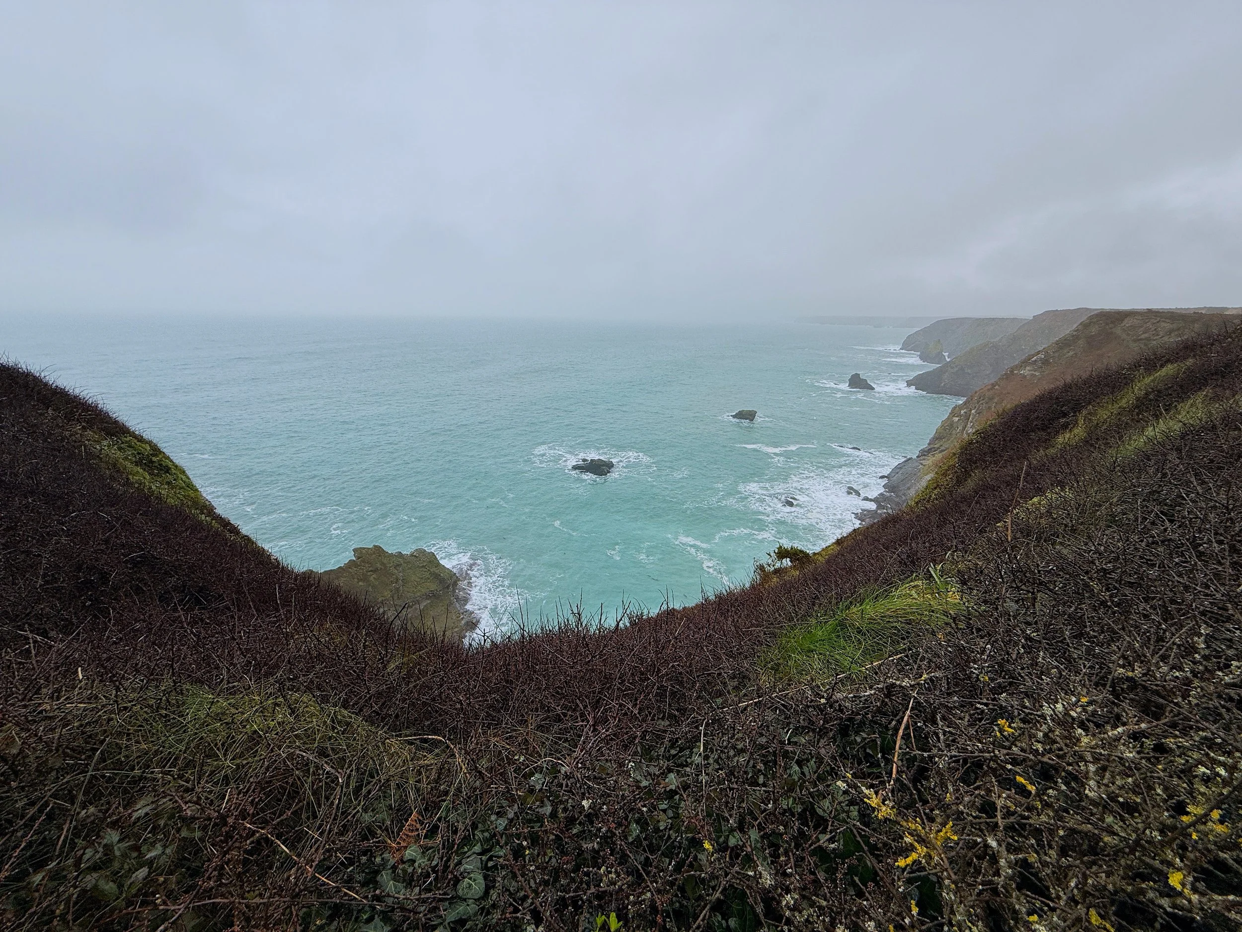
The sea was in a foul mood – in the best possible way for a camera. Big, heavy swells were charging into the reef around Godrevy Lighthouse, throwing up plumes of spray as they hit the rocks. The horizon blurred into a soft grey band where sky and water merged, and the whole scene felt properly wild.
I set up the tripod, wiped the front filter more times than I can count, and grabbed a series of stills of the strong seas hammering the coastline. Shorter shutter speeds to freeze the impact, slightly slower ones to catch streaks of foam and motion in the water. The wind made everything harder – camera shake, salt spray, cold hands – but it also gave the images that raw, stormy energy you just don’t get on calm days.
In between stills, I shot a bit of handheld video: waves exploding against the rocks, the lighthouse standing firm in the gloom, water surging through the gaps in the reef. Nothing polished, just honest clips of the coast doing its thing.
From Clifftop to TikTok
Even though I couldn’t get the aerial footage I wanted, there was still enough there for some short-form content. Once I got home and dried off, I pulled a few of the clips into the editor and cut together some quick sequences for TikTok and YouTube Shorts.
Sometimes those little vertical videos capture the feel of a place better than a longer edit – just thirty seconds of angry sea, low cloud and that isolated white tower getting battered by the elements. Not the cinematic drone run I’d planned, but still a nice snapshot of what the morning really felt like.
Third Time Lucky?
So, was it the productive drone mission I was hoping for? Not even close.
Was it still worth going? Absolutely.
Part of documenting this coastline is showing it as it actually is – not just on the perfect golden evenings, but on the grey, windy, slightly miserable days when the weather wins and you have to adapt. Those days are just as much a part of life in Cornwall as the sunsets and calm seas.
The Godrevy-to-Navax drone flight will have to wait a little longer.
Batteries are charged, memory cards are empty, and I’ll be checking the forecast like a hawk.
Try again next weekend, lol…
Navax Point to Hells Mouth
Finally the sun shone..
DAY 5
Finally in the Air
After what felt like a run of false starts, grey skies and weather-related defeats, I finally got a break. The day was noticeably brighter, the wind had eased right off compared to previous visits, and for once it felt like this stretch of coast might actually let me do what I’d been planning for weeks.
And it did.
A Better Day on the Cliffs
When I arrived, the difference was obvious straight away. The light was cleaner, the sea had more colour in it, and although there was still a breeze, it was nothing like the full-force battering I’d been dealing with on earlier trips. For the first time in a while, I felt like I wasn’t just turning up to see what the weather would ruin.
This time, I had one main goal: finally get the drone up and film the stretch from Navax Point to Hell’s Mouth.
After a few abandoned plans and no-fly mornings, just hearing the drone lift cleanly into the air felt like a win in itself.
Flying the Coast at Last
Once airborne, the coastline opened up in a way that’s hard to fully appreciate from the path alone. From the clifftops, you get the scale of it. From the air, you get the shape, the drama, and all the little hidden details that disappear when you’re standing at ground level.
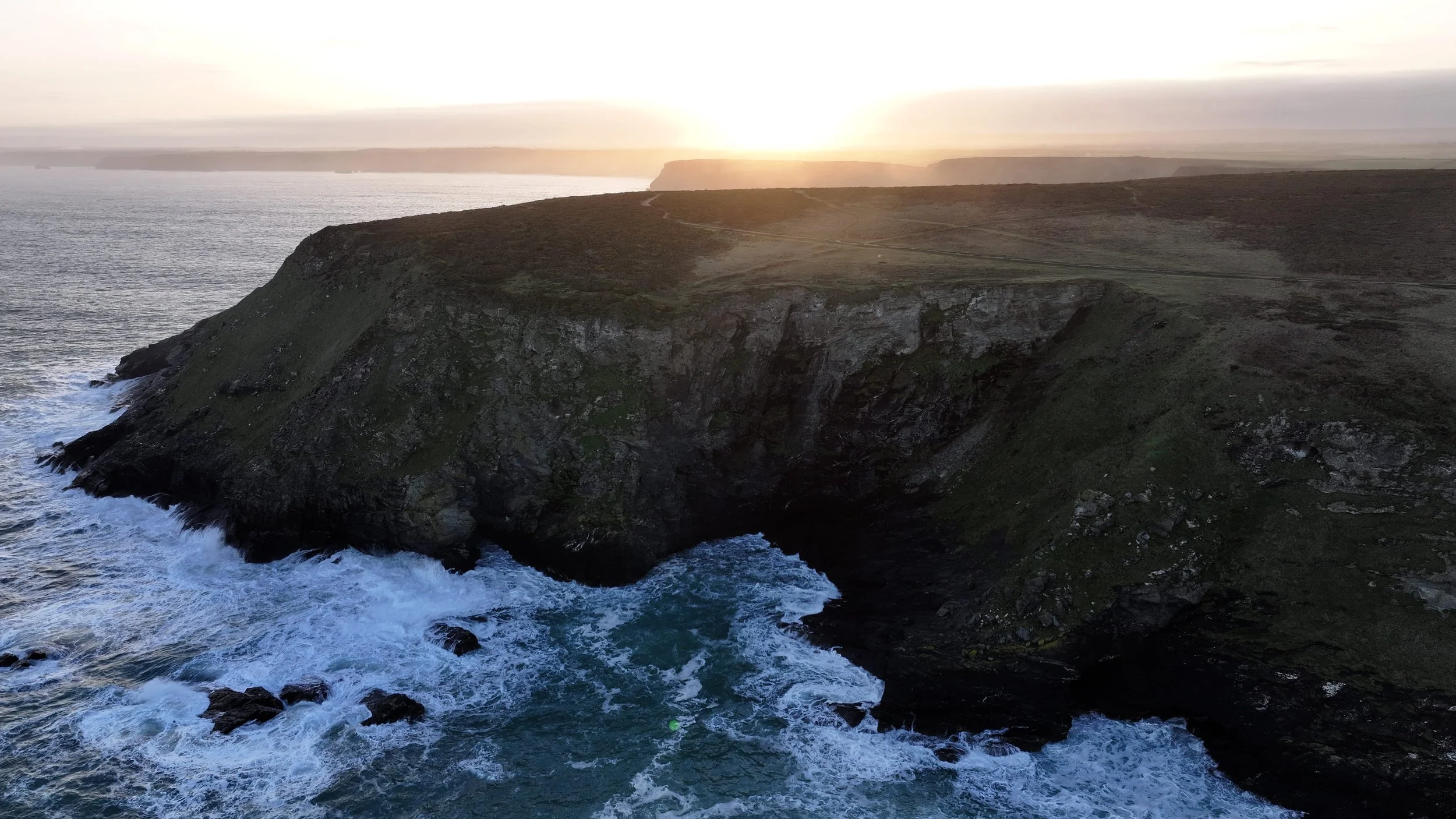
Flying from Navax Point towards Hell’s Mouth, the views were far more dramatic than I expected. I knew it would look good — this is Cornwall after all — but there were moments where the landscape genuinely surprised me.
The cliffs seemed to fold and twist into one another, with rocky outcrops, hidden inlets and dark cracks in the coastline that just don’t reveal themselves properly from above until you’re right over them. The sea below had that shifting blend of deep blue, steel grey and white foam that only really shows itself when the light is on your side.
Some sections looked wild and rugged, others almost sculpted, like the land had been carved deliberately for the camera. It’s one of those rare stretches of coast where every few hundred metres feels visually different, and that made the whole flight feel more cinematic than I’d imagined.
Unexpected Views
What stood out most to me was how many angles and shapes I hadn’t really noticed before. Even though I’d already walked parts of this route several times, seeing it from the drone gave it a completely different character.
There were coves and cliff formations that looked far more dramatic from above, and sections of shoreline that felt almost hidden until the drone moved into the right position. That’s one of the things I love most about aerial filming — it can make a familiar place feel brand new.
And then, of course, there was Hell’s Mouth itself.
Even from the ground it has a certain presence to it, but from the air the scale becomes much more obvious. The cliffs feel harsher, the drop more severe, and the sea at the base looks even more restless. It really is one of those places that earns its name.
A Proper Step Forward
This shoot felt important, not just because I finally got the drone flight done, but because it felt like a bit of progress after a frustrating run of weather setbacks. There’s only so many times you can pack the drone, drive out full of optimism, and then stand there getting damp while the forecast laughs at you.
So to finally get a brighter day, lighter winds, and usable aerial footage along this section of coast was a proper relief.
It wasn’t a dramatic golden-hour shoot, and it didn’t need to be. The cleaner light and calmer conditions were enough to let the landscape speak for itself. Sometimes that’s all you need.
Looking Back
This stretch between Navax Point and Hell’s Mouth has already given me plenty of memorable moments on foot — wind, mizzle, shredded legs from gorse, seals at Mutton Cove, and more than a few abandoned drone plans. But seeing it from the air added another layer entirely.
It reminded me that even when you think you know a place fairly well, all it takes is a change in light, a bit less wind, and a different perspective to make it feel completely new again.
And thankfully, this time, Cornwall let me have the flight.
What a view..!
My first tiktok live..!
DAY 6
Deadman's Cove to Greenbank Cove
Some mornings on the Cornish coast feel like they were made specifically for you. No wind. No cloud. The sea holding still like it's posing. This was one of those mornings — and I'd decided to make the most of it with a 4.5-mile stretch of the South West Coast Path between Deadman's Cove and Greenbank Cove, a section of the North Cliffs that sits quietly between the more talked-about drama of Hell's Mouth to the west and the bustle of Portreath to the east.
I'd also decided — finally — to go live on TikTok for the first time. More on that shortly.
Setting Out
There's something specific about stepping onto this section of the path in good conditions. The terrain gets your attention immediately — rocky and gravelly underfoot, the kind of surface that asks you to pay attention to where you're placing your feet. The coast path here runs close to the cliff edge, and the cliffs don't mess around. Sheer, dramatic drops straight down to the sea. No gentle slope, no warning — just edge, then air, then water far below.
I had the Mavic 3 on my back, the GoPro running, and I was putting the DJI Osmo Nano through its paces as a dedicated hiking camera for the first time. Compact, light, and capable enough to keep up with whatever this coastline threw at it. On a path this uneven and this exposed, you want a camera that doesn't slow you down or make you precious. The Nano passed the test.
What This Stretch Actually Looks Like
People who walk the South West Coast Path through here are often heading somewhere with a bigger name — Hell's Mouth, Portreath, St Ives eventually. This section gets passed through more than it gets noticed. That's a mistake.
The cliffs along the North Cliffs plateau are the dominant feature — heather-covered ground above, then the land simply ends and drops to the sea. Deadman's Cove has the kind of presence its name suggests: vertical rock faces, the sea contained and churning far below, and on a calm day, a silence that isn't really silence but just the complete absence of other people. No facilities, no café, no easy access down. Just the path, the edge, and whatever's going on in your head.
That solitude is the point of this stretch. It's not a performance. There's nothing here trying to impress you. It just does.
Flying the Mavic 3
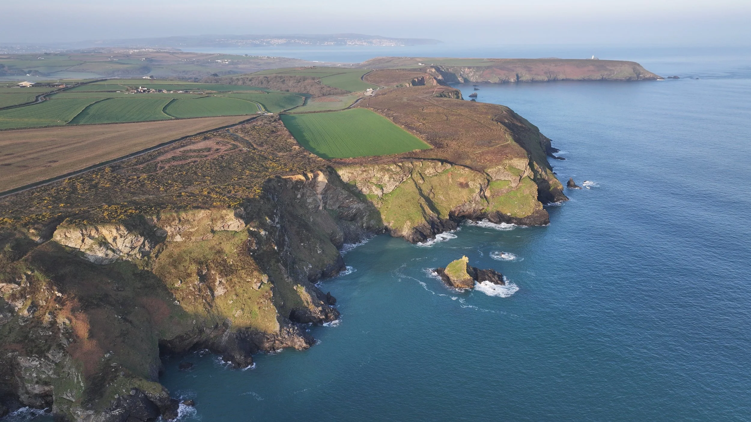
No flight restrictions on this section — clean airspace, clear skies, perfect light. I flew the Mavic 3 over the coves and cliffs, and if you've only ever seen this coastline from path level, you genuinely don't have the full picture.
From the air, the geometry of it makes sense in a way it doesn't from the ground. The way the cliffs fold and curve. The relationship between the flat heathland plateau — a former raised beach, ancient and weathered — and the sea hundreds of feet below. Greenbank Cove in particular looks completely different from altitude: a small, tucked-away sandy beach that from the path is easy to miss entirely, but from above sits like something hidden deliberately, carved into the base of the cliffs and almost entirely enclosed.
This is why I fly. The story of a place isn't always visible from where you're standing.
Greenbank Cove — and Going Live
I went live on TikTok for the first time standing above Greenbank Cove.
I'd been putting it off. It's one of those things that sounds straightforward and then feels anything but when you're actually holding the phone. But I was there, the cove was below me, the light was right, and I just did it.
People joined. Said hi. Someone asked where I was — I told them: on a cliff edge above a hidden beach on the Cornish coast, on a morning with no wind and no one else around. A few asked about the cove itself, whether you could get down to it. It broke the solitude, but not in a way that felt wrong. There was something good about sharing that view in real time, about people seeing this place the same moment I was seeing it.
It felt awkward for about the first two minutes. Then it felt fine. Then it felt like something worth doing again.
4.5 Miles That Does Something to You
This isn't a walk for a shopping list in your head. The terrain won't let you drift — too uneven underfoot, too close to the edge to be careless. But that's part of what this stretch gives you. Forced presence. By the time you reach Greenbank Cove you've been alone with the cliffs and the sea and your own thoughts for long enough that something has shifted slightly. Nothing dramatic. Just a recalibration.
That's what I keep coming back for on this Godrevy to Portreath route. Not the destination. Not even the photography, though this stretch delivered — the drone footage from above the North Cliffs is some of the best I've got on this whole series. It's the particular quality of headspace you get on a stretch of coastline that hasn't been polished up for visitors.
Cornwall doesn't always perform. Sometimes it just exists. This is one of those places.
The Final Chapter
and the day the wind tried to stop me..!
DAY 7
Bassett's Cove to Portreath
If you've been following this series from the start, you'll know I've been working my way along this stretch of the North Cornwall coast section by section — camera in hand, drone on my back, and an unreasonable enthusiasm for bacon sandwiches. Well, this is it. The final day. Bassett's Cove to the clifftop at Portreath, and honestly, Cornwall saved some of its best for last.
The wind though. Oh, the wind had other ideas.
The Day the Elements Won (Almost)
I'm not going to pretend this was a comfortable day out. The onshore wind was relentless from the moment I set off — the kind that gets inside your jacket, fills your ears, and makes you seriously question your life choices about halfway up a cliff path. The drone stayed firmly in the bag. There was no flying on this day, and I knew it before I even left the car.
But here's the thing about shooting in difficult conditions — sometimes the weather gives you something you'd never plan for.
Carvannel Downs and the Waterfall That Forgot Which Way Was Down
At the bottom of Carvannel Downs there's a small stream that cuts through the landscape and drops onto the beach below. On a calm day it's probably a quiet, unremarkable little waterfall. On this day it was doing something I've genuinely never seen before in years of walking and filming the Cornish coast.
The wind was blowing so hard onshore that the water was being pushed back upwards — the entire waterfall flowing in reverse, defying gravity right in front of my lens. I stood there for a moment just watching it, not quite believing what I was looking at. Got the shot. Glad I came.
That moment alone made the whole windy, drone-less, slightly miserable day completely worth it.
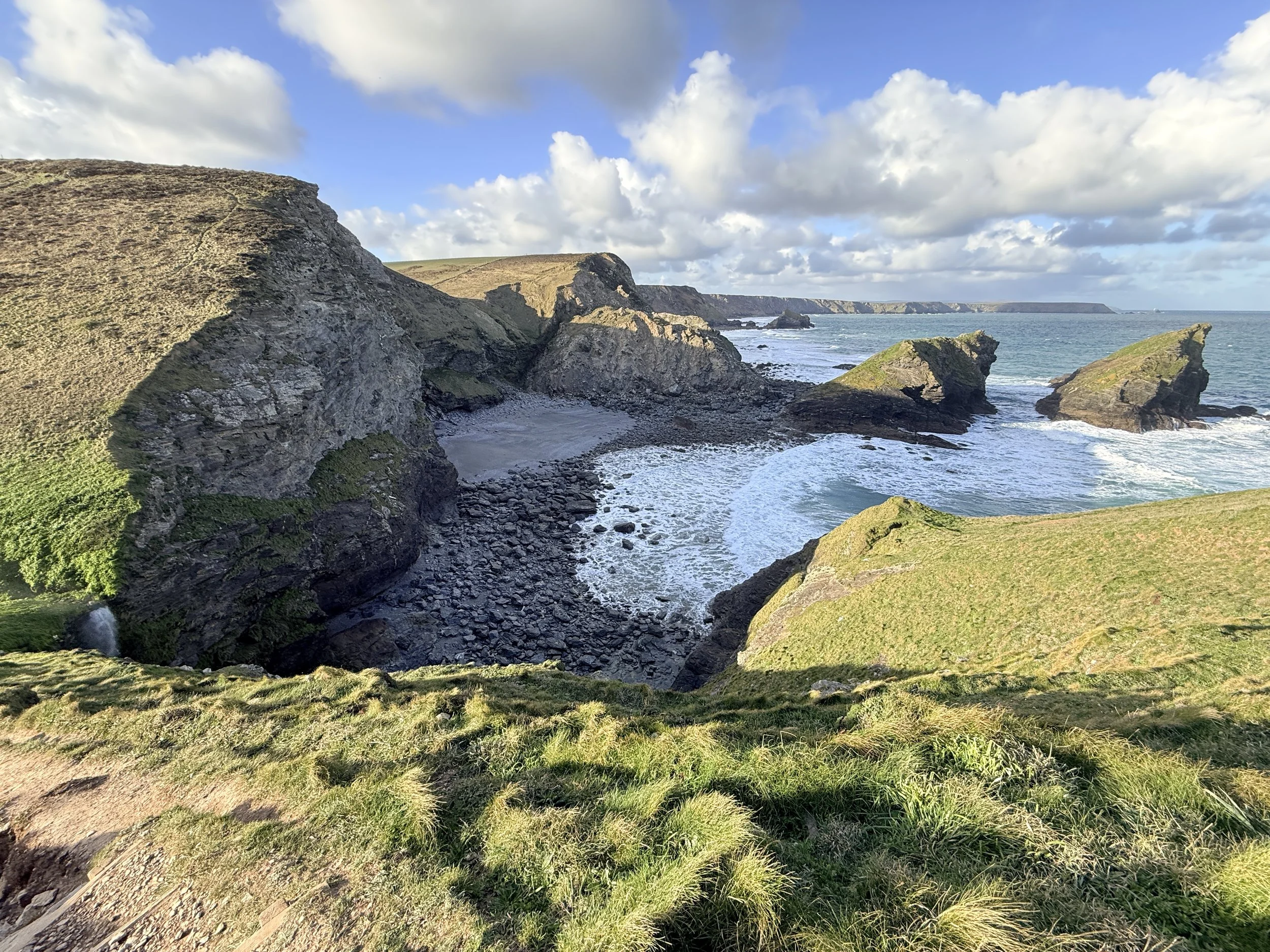
Bassett's Cove — An Underrated Gem
I'll be straight with you — I wasn't sure what to expect from Bassett's Cove going in. It doesn't get the same attention as some of the more famous spots along this stretch and that, as it turns out, is exactly why it's worth your time.
It's tucked away, quiet, and genuinely beautiful. The kind of place that rewards people who actually walk the coast path rather than just driving to the well-known car parks. The rock formations here are interesting, the beach is unspoilt, and on a calmer day — which I fully intend to return for — this is going to be a brilliant location for some long exposure work and hopefully some drone footage too.
Western Cove — Where Cornwall Gets Dramatic
If Bassett's Cove is the quiet one, Western Cove is the dramatic one. The cliffs here are imposing in the best possible way — the kind of scale that makes you feel genuinely small standing on the edge looking out at the Atlantic. Even in flat, windy light it stopped me in my tracks.
I'm already planning the return trip on a calmer day with the drone. The aerial potential here is significant and I want to do it justice properly rather than rush it.
The Clifftop at Portreath — The Finish Line
Coming into Portreath from the clifftop above the town felt like a proper ending to this whole series. Looking back along the coast knowing I'd walked and filmed every section of it — Godrevy, Hell's Mouth, Bassett's Cove, all of it — was one of those quiet moments that doesn't make it into the vlog but stays with you.
Cornwall does that. It earns its reputation every single time.
The Full Series Is Coming to YouTube
The full video covering this final stretch — including the reverse waterfall moment — is coming to the 4hotographix YouTube channel soon. If you want to see the coast path come to life with drone footage, Nikon Z6II stills and a bit of Yorkshire commentary thrown in, head over and hit subscribe so you don't miss it when it drops.
Prints From This Coastline
I'll be adding prints to the 4hotographix store soon. If you want to be the first to know when they're live — and get first look at the best shots from this entire Godrevy to Portreath series — keep an eye on the store at 4hotographix.com.
Practical Info — If You're Planning This Walk
A few things worth knowing before you head out:
The Bassett's Cove to Portreath section of the South West Coast Path is manageable for most reasonably fit walkers but the cliff sections are exposed and the path can be uneven. Wind can be brutal on this stretch — check the forecast and plan accordingly, especially if you're taking camera gear. Parking at Portreath is straightforward and there's a café in the village which, after a windy day on the cliffs, feels like the greatest place on earth.
Go on a clear day if you can. The views back toward Godrevy and St Ives Bay from the clifftop are genuinely extraordinary.